221 Morgan
Drive
(The land)Valley County parcel
0.00acres
county legal acres
0ft
of lot boundary
0ft
elevation, 4,926 to 4,932 along the line
Parcel RPM05380020190 · Valley County Assessor data · USGS aerial and elevation · Boundaries approximate
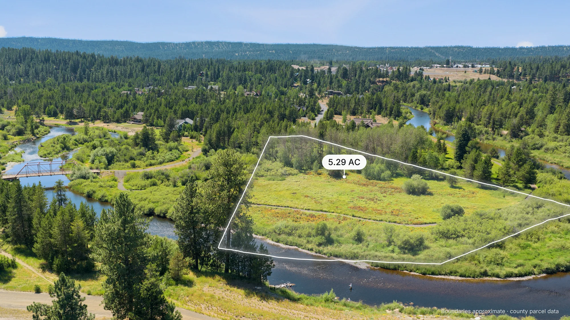
Five acres on the bend
(For the web)
Horizontal photos for the MLS and listing websites.
Places from OpenStreetMap, set into each photo from the drone's recorded camera position. Distances are straight-line from the lot.
Details
- Address
- 221 Morgan Dr, McCall, Idaho
- Legal
- River's Crossing Subdivision, Lot 19, Block 2
- Parcel
- RPM05380020190
- Size
- 5.294 acres (230,607 sq ft)
- Boundary
- 2,087 ft
- Elevation
- 4,926 to 4,932 ft
- Use
- Residential city lot, vacant
- County
- Valley County, Idaho
- Sources
- Valley County Assessor parcel data. USGS NAIP aerial imagery and 3DEP elevation (public domain). Boundaries approximate; a survey governs.
An example listing page by Lightbox Creative
Drone photos, county lot lines, and a 3D lot page like this one, for land and acreage listings in Idaho.
Photos, drone, and 3D lot by Lightbox Creative
Lot lines drawn from county parcel data. Boundaries approximate.
Six posts, ready to go
Every vertical photo comes framed for stories and reels, with the places buyers ask about pinned where they really are: the lake, the river, and Brundage. Post them as they are, or hand them to whoever runs your social.
1080 × 1920, sized for stories and reels.